Sinusoidal projection
The sinusoidal projection is a pseudocylindrical equal-area map projection, sometimes called the Sanson–Flamsteed or the Mercator equal-area projection. Jean Cossin of Dieppe was one of the first mapmakers to use the sinusoidal, appearing in a world map of 1570. The projection is defined by:
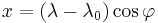

where φ is the latitude, λ is the longitude, and λ0 is the central meridian.[1]
The north-south scale is the same everywhere at the central meridian, and the east-west scale is throughout the map the same as that; correspondingly, on the map, as in reality, the length of each parallel is proportional to the cosine of the latitude; thus the shape of the map for the whole earth is the area between two symmetric rotated cosine curves. The true distance between two points on the same meridian corresponds to the distance on the map between the two parallels, which is smaller than the distance between the two points on the map. There is no distortion on the central meridian or the equator.
Similar projections which wrap the east and west parts of the sinusoidal projection around the north pole are the Werner and the intermediate Bonne and Bottomley projections.
References
- ^ Map Projections—A Working Manual, USGS Professional Paper 1395, John P. Snyder, 1987, pp. 243–248
External links
- Cybergeo article
- Table of examples and properties of all common projections, from radicalcartography.net